
Blog
How to Find A Good Fishing Spots Before You Cast?


Table of Contents
Finding a good fishing spot is not a matter of luck—it requires understanding the environment, knowing fish behavior, and using the right tools. If you are searching for “how to find fishing spots,” “best fishing spots near me,” or “where to fish for beginners,” this guide provides a structured, repeatable method to locate high-percentage fishing locations before you even cast.
What Makes a Fishing Spot “Good”?
A high-quality fishing spot typically includes three core ranking factors (think of this as your “fishing spot checklist”):
- Suitable water conditions (water temperature, current, oxygen levels);
- A consistent food source (baitfish, insects, forage);
- Strong cover and structure (weed beds, rocks, drop-offs);
When these three elements align, you are effectively targeting a high-probability fishing zone where fish naturally concentrate.
How to Find A Good Fishing Spots Before You Cast?
Monitor Water Conditions (How to Read Water for Fishing)
Start by identifying a body of water and analyzing it like a system. This is essential if you want to rank your decision-making for “best fishing locations in lakes, rivers, and ponds.”
Evaluate:
Water current (fast vs slow)
Water temperature (critical for species targeting)
Available structure and cover
Temperature is measurable, but recognizing “good fishing water conditions” comes from pattern recognition and experience.
- Observe Signs of Fish Activity
If you’re looking for “how to locate fish quickly,” these are the highest-conversion signals:
Swirls, bubbles, dimples, shadows, diving birds, flashing baitfish
Bubbles → bottom feeders like carp
Surface ripples → feeding baitfish
Splashes/jumps → active predators
Baitfish scattering → predator presence
Birds diving → baitfish schools below
Best timing: early morning and evening (peak feeding windows).
- Identify Structure and Terrain
Fish rarely stay in open water. If you’re targeting “bass fishing spots,” “pike fishing areas,” or “trout holding areas,” structure is non-negotiable.
Key structures:
Drop-offs, ledges, channels, points, flats
Shallow-to-deep transitions
Weed beds, reeds, submerged trees
Rocks, docks, bridge pilings, shaded banks
These are classic “fish holding structures” where fish conserve energy and ambush prey.
- Use Wind and Light
Wind direction directly impacts baitfish movement and therefore predator positioning.
Windblown banks = higher food concentration = better fishing spots
Low-light periods (dawn/dusk) are optimal for “fishing scouting and fish activity.”
In both freshwater and saltwater:
Bird activity = feeding zones
Mullet or baitfish movement = predator presence
If you want consistent results for “clear water fishing tips,” approach matters:
Move quietly
Avoid casting shadows
Minimize vibration and noise
Fish are highly sensitive to pressure, vibration, and silhouettes, especially in clear water conditions.
You don’t need to fish every inch of water to understand the situation. Try new spots and learn how to read the water. Not every fishing spot is worth visiting; trust me, we’ve all said, “The fish are definitely here!”
If it’s a local spot, take short walks, visit it quickly a few times, observe, and familiarize yourself with the environment. Try fishing a few times; it’s fine. Walk around and pay attention to the characteristics of new areas.
Find the Food Source (Where Fish Feed)
Best conditions + food = fish.
This is one of the most searched concepts behind:”why fish are not biting”, “how to locate fish in any water”
- Focus on:
Insect hatches
Baitfish presence
Feeding timing (morning/evening/seasonal)
- Examples:
Mayfly hatch = topwater feeding frenzy
Seasonal baitfish migration = predator movement
Build a “fishing calendar” around feeding events for predictable success.
Match the Target Species (Species-Specific Fishing Strategy)
Different species = different search intent + different habitats
If you’re optimizing for “best lures for trout / bass / pike,” you must match environment + behavior.
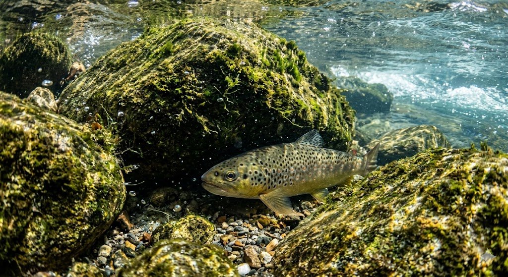
Examples:
- Trout Fishing Spots
Cold, oxygen-rich rivers
Behind rocks, near currents
Best lures: blade spinnerbait, jerkbaits, minnow crankbaits
- Pike Fishing Spots
Slow water with heavy cover
Weeds, submerged wood, drop-offs
Best lures: weedless spoons, swimbaits, chatterbait lures
- Bass Fishing Spots
Structure-oriented
Warm seasons → shade, docks, vegetation
Spring → shallow water
Keep a Fishing Log
As you explore more areas, the factors influencing the quality of fishing spots will gradually accumulate. While it’s possible to remember many important factors, it’s best to take notes for future reference. Some opportunities are fleeting, so having these references is truly helpful.
If you want to improve rankings for “consistent fishing success,” you need data.
- Track:
Species caught
Weather conditions
Water level
Lure used
Time and location
Over time, this becomes your personal fishing database, improving decision accuracy.
For example, I witnessed a very rare molting of giant mayflies in a lake where trout are scarce. However, the trout there are quite large, and the molting even attracted them to the surface to feed voraciously. Adding these events to your calendar is a good idea. This will automatically remind you to go to the best places at the best times of the year.
Use Apps and Tools (Best Fishing Apps & Maps)
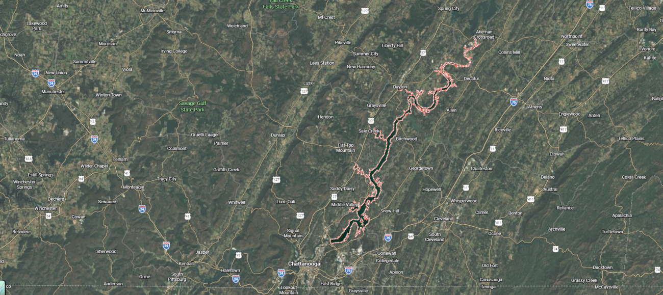
Google earth + trial and error. You can use it to highlight river bends, tributaries, pools downstream of dams, and small, unmarked lakes or ponds—especially those hidden away from roads and traffic. These places are often overlooked and have relatively scarce fish populations.
- Google Maps
For online exploration, Google Maps’ satellite views are free and easy to use. You can use it to mark your favorite locations and add annotations.
Google Earth’s uses extend far beyond this. Satellite views allow you to discover underwater features such as sandbars, steep slopes, and vegetation. Zooming in on the coastline reveals gullies, rock formations, and even tidal lines. Switch between historical images and images from different seasons—sometimes, images from low tide in winter reveal underwater features that are never visible in summer.
- OnX Maps
Some paid applications are also worth the money. I use OnX Maps for hunting, fishing, and scouting new hunting and fishing spots. It provides a 3D view, allowing me to mark potential vessel passageways, walking paths, and add custom annotations based on various variables.
- Navionics
Navionics are essential for fishing on large lakes and in the ocean. With Navionics, finding steep slopes, channels, channel funnels, and other key features becomes much easier. These Navionics, also known as depth charts, are available from the National Oceanic and Atmospheric Administration (NOAA) and many other agencies. They are invaluable for research purposes.
- Other Applications
In addition, there are applications such as fishing spot finders from Fishbrain, and Angling Direct that can help anglers find new fishing spots. These applications can display depth contours, user-generated catch data, and helpful notes. Many of these applications also help search for “nearby fishing spots,” “nearby fishing ponds,” or “nearby fishing areas.”
- Region-Specific Apps
In some regions—particularly in the US, UK, Sweden, and Australia—there are state or country-specific apps that offer additional features:
Display public and private fishing areas.
Provide real-time catch reports.
Allow you to purchase fishing licenses on the spot.
Highlight seasonal rules, local restrictions, and closed areas.
For example:
In the UK, the Fishing Trust’s fishing information app lists fishing spots, competition schedules, and rules.
In the US, many states (such as Florida, Texas, and California) have official wildlife apps for purchasing licenses and viewing fishing regulations.
In Sweden, the iFiske app is widely used to find waters, purchase licenses, view maps, and look up local fishing rules—all on one platform. It’s especially useful when heading to new fishing areas or planning trips to remote lakes and rivers.
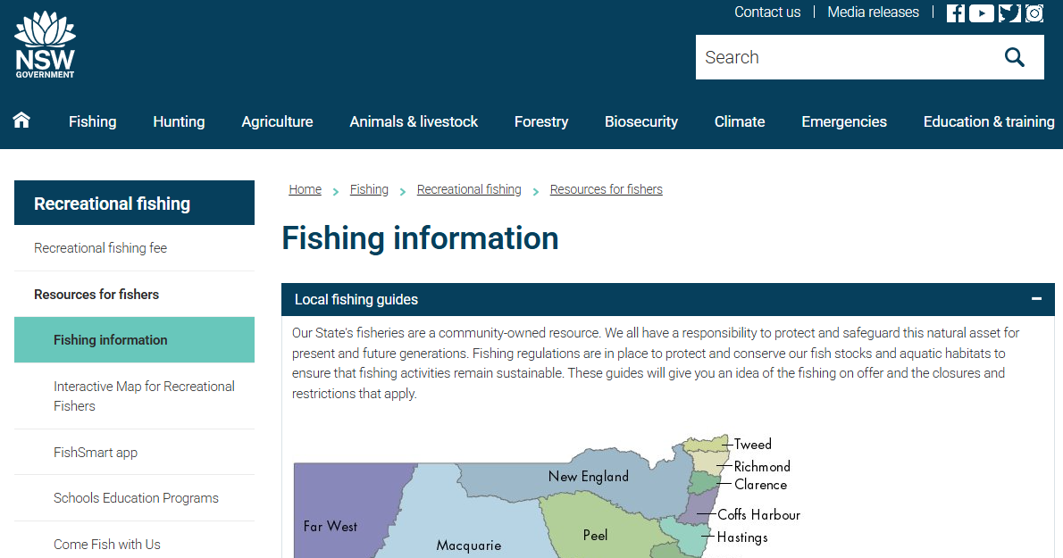
In Australia, state-level apps like NSW DPI Fishing or Vic Fishing give anglers access to rules, maps, and alerts.
Minnesota has a lake finder website (Lakefinder) that lists public water inlets, along with fish species and invasive species for each lake. The state Department of Natural Resources (DNR) website has lake survey results, which was very helpful. Later, I tried to fish at selected lakes multiple times to get a comprehensive understanding of the lake’s condition.
If you’re traveling or exploring new areas, it’s always worth checking for official or popular fishing apps. It can save time, ensure your fishing is legal and compliant, and sometimes even help you discover hidden gems not found on forums.
You can also buy a map of your state, which can provide timely information that apps can’t offer. While there are many tools available, physically exploring new areas remains the best way to find new fishing spots.
Local Knowledge
Maps can’t replace experience. Local anglers, tackle shop owners, and even dog walkers often know more than you think.
Avenues for information include:
Tack shops
Local anglers
Local chapters of fishing clubs and national organizations
Facebook groups/forums/YouTube
- Tackle Shops
Tack shops are an excellent source of information about fishing spots—the better you fish, the more tackle you buy. If you’re looking for help, be sure to visit their shops.
- Local Anglers
The trick is in the questions. Instead of directly asking, “Where’s a good place to fish?”, start by talking about the local area. Share some of your own fishing experiences. Say you’re just visiting and looking for a quiet spot to fish. You’ll be surprised how much information people share when they realize you genuinely want to find a fishing spot, not just to get their “secret hideout.”
- Local Fishing Clubs and National Organizations
Local chapters of fishing clubs and national organizations are also treasure troves of information. Even if you’re not (currently) a member, many clubs have websites or social media pages that provide clues about their fishing spots. Joining a club, even temporarily, can give you access to private waters, forums, briefings, and most importantly—meet club members who enjoy sharing their knowledge.
- Facebook Groups / Forums / YouTube Joining Local
Facebook fishing groups has been very helpful, providing me with many useful tips. While many anglers are tight-lipped about their fishing secrets, some are surprisingly generous online.
Some niche Facebook groups (especially local or species-specific groups) frequently share catch reports, photos, and general fishing spot locations. Forums might mention a stretch of river “not far upstream from the old bridge” or a lake “accessible only from the north bank.”
YouTube is a treasure trove for finding new fishing spots—and it’s completely free. Watching other anglers fish in locations that interest you can give you a more intuitive understanding of the terrain and topography. You can usually see the location of the entry point, the direction of the river flow, the water clarity, and even what kinds of fish have been caught.
This is also a good way to understand which methods are effective. Are people using float fishing? Casting crank bait? Or drifting finesse worm? Observing others’ operations can give you a head start and prevent you from being completely clueless.
Conclusion
Finding better fishing spots is a repeatable skill built on observation, pattern recognition, and data tracking. The more you refine your ability to read water, identify structure, and locate feeding zones, the more consistent your results become.
If you’re serious about improving results, stop guessing and start applying systematic fishing spot analysis.
FAQ
What is the best time to fish?
Fish are generally most active during low-light periods. Peak windows are typically 6–9 AM and 11 PM–2 AM, depending on species and moon phase.
How do I find fishing spots fast?
Use a combination of fishing apps, satellite maps, and real-world observation. Focus on structure + food + cover intersections, which are statistically the most productive fishing areas.
Are fishing apps accurate?
Fishing apps are highly effective for identifying potential hotspots, but they rely on historical and user-generated data. Always validate conditions on-site for best results.
9 thoughts on “How to Find A Good Fishing Spots Before You Cast?”